


Northwest Triangle Specific Plan
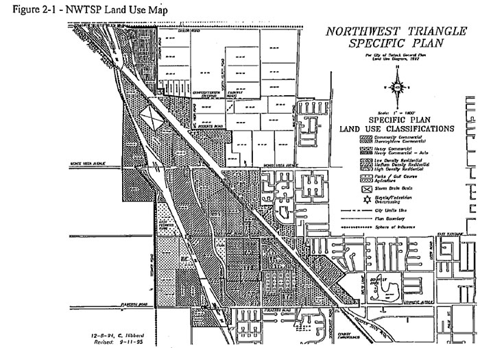
Adopted in 1995, the Northwest Triangle Specific Plan encompasses approximately 800 acres located in a triangle created by Golden State Boulevard, Highway 99 and Fulkerth Road. The Specific Plan Area is located at the City's northwest edge and will remain so under the current Turlock General Plan.
The four principal goals of the Northwest Triangle Specific Plan are:
- Implement the City of Turlock General Plan;
- Allow development to proceed without unnecessary delay;
- Provide for the efficient extension of services; and
- Establish funding mechanisms for improvements.
The Specific Plan guides the development of the area through its land use designations, design guidelines, natural resource conservation program, infrastructure master plans, and implementation program. The design guidelines complement and refine the design guidelines adopted by the City for commercial and residential development.
WARNING NOTE: The use charts in the Northwest Triangle Specific Plan have been superseded by the current Zoning Ordinance. The Design Guidelines within this Master Plan are still in effect for this area. Please refer to Title 9 of the Turlock Municipal Code for Zoning District Information.
Northwest Triangle Specific Plan
Northwest Triangle Specific Plan Draft MEIR
Northwest Triangle Specific Plan Final MEIR